Dosiero:Kosovo adm location map.svg

Paĝenhavo ne ekzistas en aliaj lingvoj.
El Vikivojaĝo

Fonta dosiero(SVG-dosiero, 1 014 × 1 109 rastrumeroj, grandeco de dosiero: 185 KB)

Ĉi tiu dosiero estas de Wikimedia Commons kaj estas uzebla de aliaj projektoj. Jen la priskribo en ties dosier-priskriba paĝo.

Resumo

Priskribo
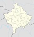
Deutsch: Positionskarte des Kosovo
English: Location map of Kosovo

Equirectangular projection, vertical stretching 135 %
Border coordinates

43.3
19.8←↕→21.9
41.7
 Informaĵo This map is part of a series of location maps with unified standards: SVG as file format, standardised colours and name scheme. The boundaries on these maps always show the de facto situation and do not imply any endorsement or acceptance. In case of changes of the shown area the file is updated. The old version will be uploaded as a new file and thus is still available.
Dato
Fonto

Own work using:

  • United States National Imagery and Mapping Agency data
Aŭtoro NordNordWest
Ceteraj versioj
SVG genesis
InfoField
 
The SVG code is valid.
 
Ĉi tiu dosiero estas kreita per Adobe Illustrator.
Kartenwerkstatt
This SVG map has been made or improved in the German Kartenwerkstatt (Map Lab). You can propose maps to improve as well.

Permesiloj:

Usage of this file with:

explanatory notes: Legally binding is only the full legalcode. For a free usage I recommend to respect the following licence conditions:
1. Provide my name as given above: NordNordWest,
2. a copy of, or the URI for, the applicable license: https://creativecommons.org/licenses/by-sa/3.0/de/legalcode,
3. the title of the work,
4. in the case of an adaptation, a credit identifying the use of the work in the adaptation.
This license and the rights granted hereunder will terminate automatically upon any breach by you of the terms of this license. Any of the above conditions can be waived if you get permission from the copyright holder. If you have questions or wish differing conditions, please contact me through nnwest@t-online.de or my discussion page

w:eo:Creative Commons
atribuite samkondiĉe
Ĉi tiu dosiero estas disponebla laŭ la permesilo Krea Komunaĵo Atribuite-Samkondiĉe 3.0 Germanujo.
Atribuite: Karte: NordNordWest, Lizenz: Creative Commons by-sa-3.0 de
Vi rajtas:
  • kunhavigi – kopii, distribui kaj publikigi la verkon
  • aliigi – modifi, adapti, kompletigi, transformi, uzi la tutan verkon aŭ ties partojn, memstare aŭ en aliaj verkoj
La verko rajtas esti kunhavigata nur:
  • atribuite – Vi devas atribui aŭtorecon, liveri ligilon al la permesilo kaj marki ĉu ŝanĝoj estis faritaj. Faru tion en aprobinda maniero, tamen ne sugestante, ke permesinto aprobas vin aŭ vian uzon.
  • samkondiĉe – Se vi rekombinas la verkon, transformas ĝin aŭ kreas devenaĵon bazitan sur ĝi, vi rajtas distribui la rezultan verkon nur laŭ la sama aŭ kongrua permesilo kompare kun ĉi tiu.

Titoloj

Donu unulinian priskribon de la enhavo de ĉi tiu dosiero

Eroj prezentitaj en ĉi tiu dosiero

montras

Dosiera historio

Klaku daton/tempon por vidi la dosieron kia ĝi aspektis tiam.

Dato/tempoBildetoDimensiojUzantoKomento
nuna18:29, 17 mar. 2020Bildeto por versio ekde 18:29, 17 mar. 20201 014 × 1 109 (185 KB)NordNordWestReverted to version as of 13:31, 16 March 2018 (UTC), not without a discussion
12:15, 17 mar. 2020Bildeto por versio ekde 12:15, 17 mar. 2020512 × 560 (119 KB)ZvuqnikiReverted to version as of 13:09, 16 March 2018 (UTC)
12:12, 17 mar. 2020Bildeto por versio ekde 12:12, 17 mar. 20201 014 × 1 109 (210 KB)ZvuqnikiThis map reflects the current reality regarding the border of Kosovo. Serbia has no authority over Kosovo, and there are police and military forces that all Kosovo borders.
13:31, 16 mar. 2018Bildeto por versio ekde 13:31, 16 mar. 20181 014 × 1 109 (185 KB)NordNordWestReverted to version as of 18:29, 12 January 2018 (UTC) Serbia still thinks that Kosovo is part of Serbia, so it stays with a dashed line
13:09, 16 mar. 2018Bildeto por versio ekde 13:09, 16 mar. 2018512 × 560 (119 KB)HakuliKosovo new map updatet. The dashlines are removed. The dashlines are used only when is shown a larger map.
18:29, 12 jan. 2018Bildeto por versio ekde 18:29, 12 jan. 20181 014 × 1 109 (185 KB)NordNordWest== {{int:filedesc}} == {{Information |Description= {{de|1=Positionskarte des Kosovo}} {{en|1=Location map of Kosovo}} {{Location map series N |stretching=135 |top=43.3 |bottom=41.7 |left=19.8 |right=21.9 }} |Source={{Own using}} * United States Nationa...

La jenaj paĝoj ligas al ĉi tiu dosiero:

Suma uzado de la dosiero

La jenaj aliaj vikioj utiligas ĉi tiun dosieron:

Vidi plian ĝeneralan uzadon de ĉi tiu dosiero.

Metadatumoj