Dosiero:Italian Alps and plains ESA394767.jpg

Fonta dosiero (12 644 × 8 510 rastrumeroj, dosiera grandeco: 15,54 MB, MIME-tipo: image/jpeg)
Ĉi tiu dosiero estas de Wikimedia Commons kaj estas uzebla de aliaj projektoj. Jen la priskribo en ties dosier-priskriba paĝo.
Resumo
| Atentu | La originala dosiero havas multe da bilderoj, kaj lanĉi ĝin plen-distingive povus kaŭzi mis-ŝargon aŭ frostigon de retumilo. Tiujn problemojn oni povas eviti per uzado de ZoomViewer. |
|---|
| PriskriboItalian Alps and plains ESA394767.jpg |
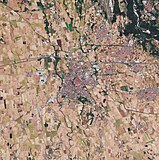
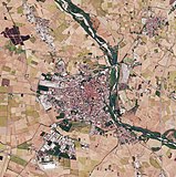
English: The Copernicus Sentinel-2B satellite takes us over the Italian Alps and down to the low plains that surround the city of Milan.
The image captures the transition between the high snow-capped peaks of the Italian Alps and the flatlands of the northwest Po Valley. This transition cuts a sharp diagonal across the image, with the mountains in the top left triangle and the flat low-lying land in the bottom right. The southern part of the beautiful Lake Maggiore can also be seen in the image. Although its northern end crosses into Switzerland, Lake Maggiore is Italy’s longest lake and its character changes accordingly. The upper end is completely alpine in nature and the water is cool and clear, the middle region is milder lying between gentle hills and Mediterranean flora, and the lower end advances to the verge of the plain of Lombardy. The River Ticino, which rises in Switzerland and flows through Lake Maggiore, can be seen emerging from the lake’s southern tip. Here, the land, which is one of the most fertile regions in Italy, gives way to numerous agricultural fields, which are clearly visible to the west of the river. The city of Milan lies to the east of the river. In May 2019, Milan will host ESA’s Living Planet Symposium. Held every three years, these symposia draw thousands of scientists and data users from around the world to discuss their latest findings on the environment and climate. This image, which was captured on 9 October 2017, is also featured on theEarth from Space video programme. |
||
| Dato | |||
| Fonto | http://www.esa.int/spaceinimages/Images/2018/06/Italian_Alps_and_plains | ||
| Aŭtoro | European Space Agency | ||
| Permeso (Reuzo de la dosiero) |
contains modified Copernicus Sentinel data (2017), processed by ESA,CC BY-SA 3.0 IGO | ||
| Ceteraj versioj |
|
||
| Title InfoField | Italian Alps and plains | ||
| System InfoField | Copernicus | ||
| Set InfoField | Earth observation image of the week | ||
| Location InfoField | Italy | ||
| Mission InfoField | Sentinel-2 | ||
| Activity InfoField | Observing the Earth |
Permesiloj:
- Vi rajtas:
- kunhavigi – kopii, distribui kaj publikigi la verkon
- aliigi – modifi, adapti, kompletigi, transformi, uzi la tutan verkon aŭ ties partojn, memstare aŭ en aliaj verkoj
- La verko rajtas esti kunhavigata nur:
- atribuite – Vi devas atribui aŭtorecon, liveri ligilon al la permesilo kaj marki ĉu ŝanĝoj estis faritaj. Faru tion en aprobinda maniero, tamen ne sugestante, ke permesinto aprobas vin aŭ vian uzon.
- samkondiĉe – Se vi rekombinas la verkon, transformas ĝin aŭ kreas devenaĵon bazitan sur ĝi, vi rajtas distribui la rezultan verkon nur laŭ la sama aŭ kongrua permesilo kompare kun ĉi tiu.


|
This image contains data from a satellite in the Copernicus Programme, such as Sentinel-1, Sentinel-2 or Sentinel-3. Attribution is required when using this image.
Atribuite: Contains modified Copernicus Sentinel data {{{year}}}
Attribution
The use of Copernicus Sentinel Data is regulated under EU law (Commission Delegated Regulation (EU) No 1159/2013 and Regulation (EU) No 377/2014). Relevant excerpts:
Free access shall be given to GMES dedicated data [...] made available through GMES dissemination platforms [...].
Access to GMES dedicated data [...] shall be given for the purpose of the following use in so far as it is lawful:
GMES dedicated data [...] may be used worldwide without limitations in time.
GMES dedicated data and GMES service information are provided to users without any express or implied warranty, including as regards quality and suitability for any purpose. |
Attribution
Titoloj
Eroj prezentitaj en ĉi tiu dosiero
montras
1 jun. 2018
Dosiera historio
Klaku daton/tempon por vidi la dosieron kia ĝi aspektis tiam.
| Dato/tempo | Bildeto | Dimensioj | Uzanto | Komento | |
|---|---|---|---|---|---|
| nuna | 15:58, 1 jun. 2018 |  | 12 644 × 8 510 (15,54 MB) | Fæ | European Space Agency, Id 394767, http://www.esa.int/spaceinimages/Images/2018/06/Italian_Alps_and_plains, User:Fæ/Project_list/ESA |
Dosiera uzado
Neniu paĝo ligas al ĉi tiu dosiero.
Suma uzado de la dosiero
La jenaj aliaj vikioj utiligas ĉi tiun dosieron:
- Uzado en it.wikiquote.org
Metadatumoj
Ĉi tiu dosiero enhavas plian informon, verŝajne aldonitan de la cifereca fotilo aŭ skanilo uzita por krei aŭ skani ĝin. Se la dosiero estis modifita de sia originala stato, iuj detaloj eble ne konformos al efektiva stato de la modifita bildo.
| Larĝeco | 12 644 px |
|---|---|
| Alteco | 8 510 px |
| Bitokoj en komponanto |
|
| Komponaĵo de rastrumeroj | RGB |
| Orientiĝo | Normala |
| Nombro de komponaĵoj | 3 |
| Horizontala distingivo | 72 dpi |
| Vertikala distingivo | 72 dpi |
| Programaro uzata | Adobe Photoshop CC (Windows) |
| Dato kaj tempo de dosiera ŝanĝo | 16:59, 17 jan. 2018 |
| Exif-versio | 2.21 |
| Kolor-spaco | Nekalibrita |
| Dato kaj tempo de ciferecigado | 14:05, 11 okt. 2017 |
| Dato kiam metadatumoj estis laste modifitaj | 17:59, 17 jan. 2018 |
| Unika identigo de originala dokumento | xmp.did:40d4efd7-f5e0-3f46-beb1-8f8704621e5b |


